To discover more Mineral Mining sites in Maine and all over the world, visit Mineral Resource Data System
Maine Geologic Survey hosts an interactive map, highlighting Maine’s mineral resources, published by the Maine Department of Agriculture, Conservation and Forestry.
Maine DEP Mining Sites features an interactive map and in-depth data of each site.
And here you can read about all proposed, imagined and actual mines in Washington County.
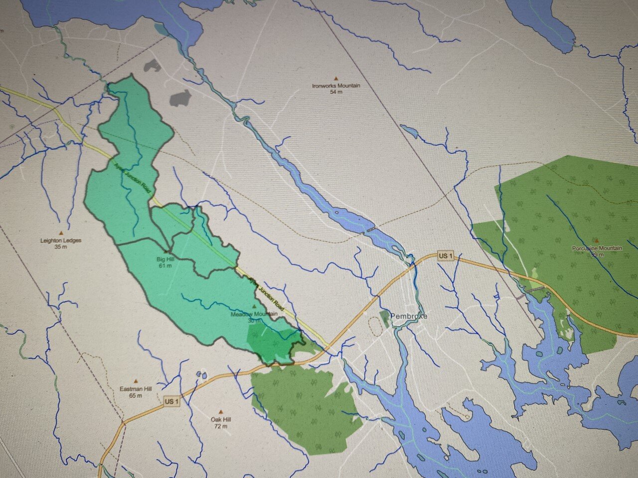
First two maps are the area Wolfden is proposing to mine in Pembroke.

The land Wolfden has secured mineral rights to are the Pembroke and Timberland Plots just south of the pink circle.
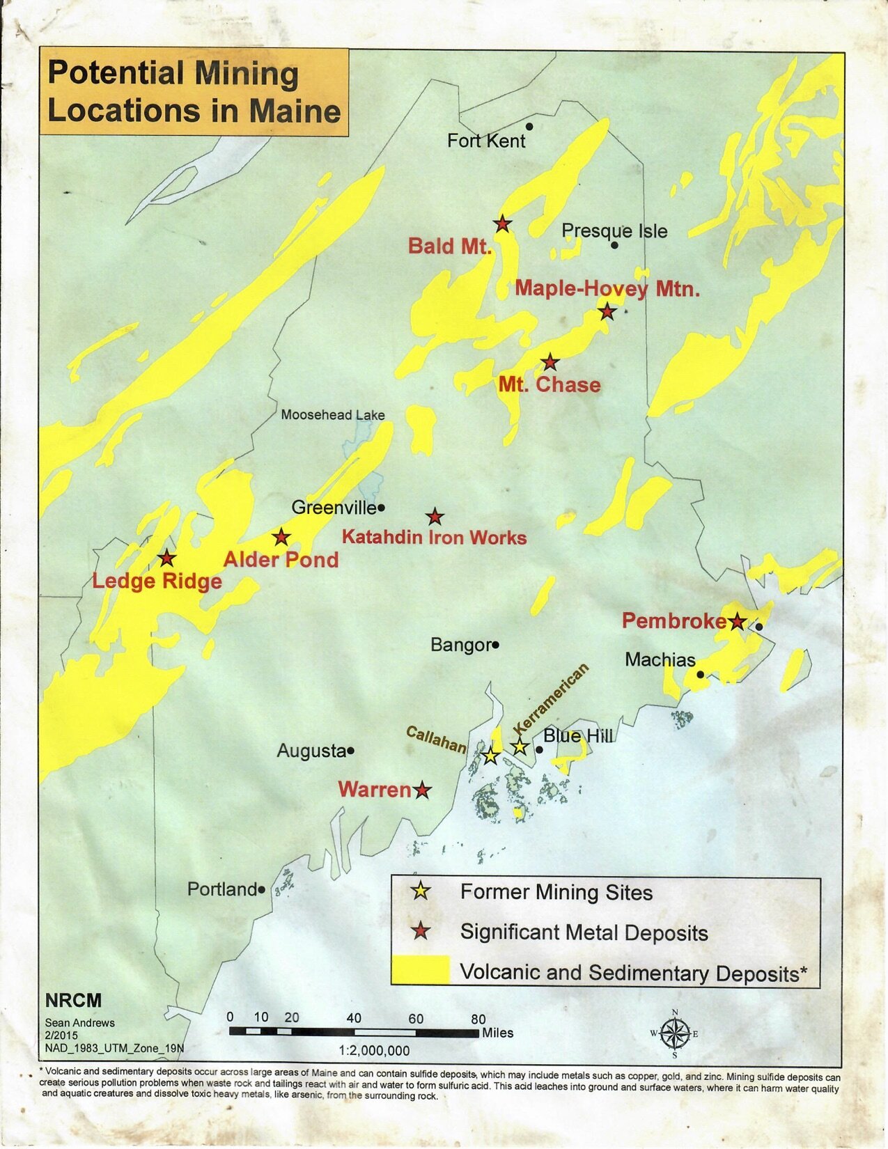
Potential Mining Location in Maine

The United States Iron Industry in 1959. Blast furnaces and the clustering of production sites.

From the Mineral Resources Data System

Maine's Mineral Resources from the Maine Geologic Survey

We have been compiling information about the location of this proposed mine.
The landowner map.
The watershed map.
The water table/ hydrology map.
If you have other maps that you’d like to see up here as public information, please email it to malcolmdrenttel@gmail.com